Project Description
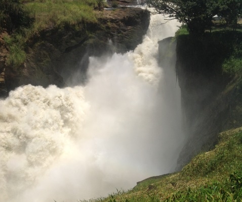
The Murchison Falls National Park lies at the northern end of the Albertine Rift Valley, where the bulky Bunyoro escarpment merges into the vast plains of Acholiland. The park is bisected by the Victoria Nile which first races down the whitewater rapids before plunging over the remnant rift valley wall at Murchison Falls, the centerpiece of the park.
This waterfall was named by Samuel Baker an explorer who considered it the most important obect through the entire course of the river. The falls drain the last of the river’s energy, transforming it into a broad, placid stream that flows quietly across the rift valley floor to Lake Albert.
The park covers 3893km² and is Uganda’s largest protected area. The Albert Nile corridor is Uganda’s lowest area and temperatures can be hot with a maximum of 29°C.
The park is dominated by savanna woodland, river/wetland and tropical forest habitats which provide homes for numerous mammal species and bird species.


